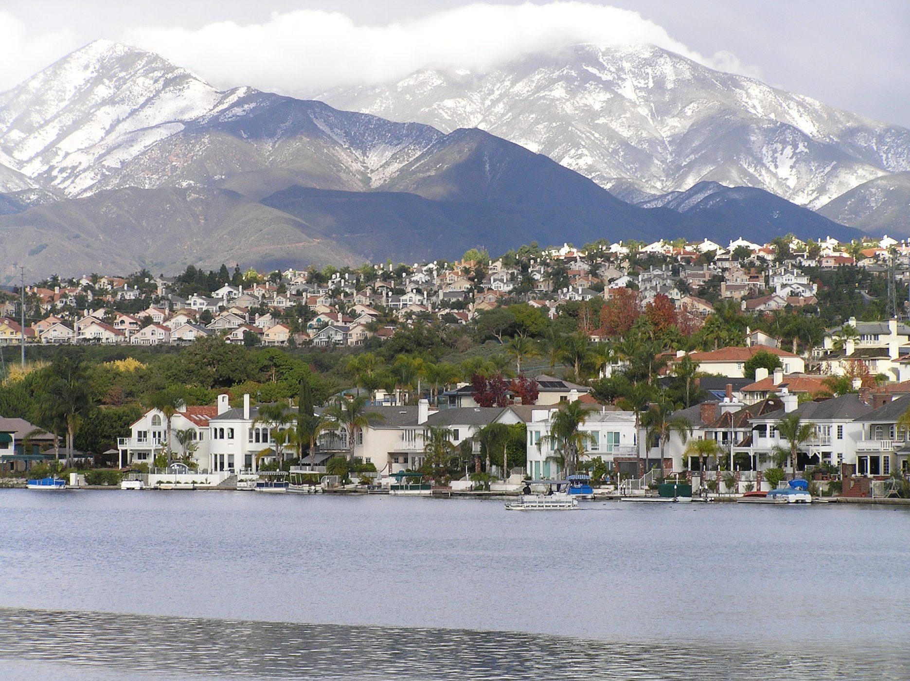
Lake Mission Viejo beneath the Saddleback Mountains

Outdoors

Biking and mountain biking near Mission Viejo

Trails and recreation areas near Mission Viejo open to biking and mountain biking.

Good to know: Wilderness areas are closed to bikes; check each area’s trail rules and yield to hikers and horses.

Within 30 miles (2)

12 mi east · USDA Forest Service · Campground

Falcon Group

Falcon Group Campground has three individual group campsites just off the scenic Ortega Highway in Southern California, which connects San Juan Capistrano and Temecula Valley Highway.

  • Biking
  • Camping
  • Hiking
  • Mountain Biking
  • Photography
  • Scenic Drive
  • Star Gazing
  • Wilderness

25 mi northwest · US Army Corps of Engineers

Brea Dam

The recreation facilities at this project are managed by the City of Fullerton (CA) Community Services. Golf and tennis are main attractions at this project, located among the picturesque rolling hills in the City of Fullerton.

  • Biking
  • Hiking
  • Horseback riding
  • Hotel/Lodge/Resort Privately Owned
  • Picnicking

30 to 75 miles (11)

38 mi northwest · US Army Corps of Engineers

Whittier Narrows Dam

This project is managed by Los Angeles County Parks and the City of Pico Rivera. Whittier Narrows has no permanent pool.

  • Biking
  • Boating
  • Horseback riding
  • Picnicking
  • Water sports
  • Wildlife viewing

41 mi northeast · USDA Forest Service

San Bernardino National Forest

  • Biking
  • Camping
  • Climbing
  • Fishing
  • Hiking
  • Horse Camping
  • Horseback riding
  • Hunting

44 mi northwest · USDA Forest Service

Angeles National Forest

  • Biking
  • Camping
  • Fire Lookouts/Cabins Overnight
  • Hiking
  • Horse Camping
  • Horseback riding
  • Off-highway vehicles
  • Picnicking

50 mi southeast · USDA Forest Service · Campground

Crestline Group Campground

Crestline Group Campground is located in a wooded area on Palomar Mountain, at approximately 5,390 feet in elevation. Many trees including Black Oak, Cedar, White Fir and Live Oak surround the site.

  • Biking
  • Camping
  • Hiking
  • Ranger programs

52 mi north · USDA Forest Service · Campground

Deer Group Camp

Deer Group Campground is a great place to bring an extended family or large group.

  • Biking
  • Boating
  • Camping
  • Fishing
  • Hiking
  • Swimming
  • Water sports

54 mi east · USDA Forest Service · Campground

Boulder Basin

Black Mountain Road is is poor condition at this time. A four-wheel drive (4WD) vehicle is recommended with a minimum ground clearance of 6 inches. Drive at your own risk.

  • Backpacking
  • Biking
  • Camping
  • Fishing
  • Hiking
  • Horseback riding
  • Mountain Biking
  • Picnicking

54 mi north · USDA Forest Service · Campground

Meadow Group Campground

Meadow Group Campground is located off State Highway 2 between the Manzanita Loop of the Chilao Campground and the Chilao Ranger Station, 26 miles north of the 210 Freeway in La Canada, California.

  • Biking
  • Birding
  • Camping
  • Hiking
  • Ranger programs
  • Wildlife viewing

61 mi northeast · Bureau of Land Management

Juniper Flats

Juniper Flats covers 101,272 acres of mixed public and private lands. Located between the Mojave Desert and the forests of the San Bernardino Mountains, Juniper Flats hosts a unique mixture of plants from both environments.

  • Biking
  • Camping
  • Hiking
  • Horseback riding
  • Hunting
  • Nature education
  • Off-highway vehicles
  • Photography

61 mi northwest · US Army Corps of Engineers

Sepulveda Dam

The Sepulveda Dam's recreation facilities are managed by the City of Los Angeles Parks.

  • Biking
  • Boating
  • Picnicking
  • Water sports
  • Wildlife viewing

71 mi north · Bureau of Land Management

El Mirage OHV Area

Remember your OUTDOOR ETHICS when enjoying your public lands. Please RECREATE RESPONSIBLY.

  • Biking
  • Camping
  • Hiking
  • Off-highway vehicles

73 mi northwest · National Park Service

Santa Monica Mountains National Recreation Area

The Santa Monica Mountains offer easy access to surprisingly wild places. Experience the famous beaches of Malibu or explore more than 500 miles of trails.

  • Biking
  • Camping
  • Climbing
  • Hiking
  • Horseback riding

Distances are straight-line miles from downtown Mission Viejo. Listings come from Recreation.gov’s federal recreation database; check each official page for hours, fees, fire restrictions and closures before you go.

More outdoors near Mission Viejo

Questions

Where is the closest place for biking near Mission Viejo?

Falcon Group (USDA Forest Service), about 12 miles east of Mission Viejo as the crow flies. Next are Brea Dam (25 mi) and Whittier Narrows Dam (38 mi).

When is the best time for biking near Mission Viejo?

Based on Mission Viejo’s average highs, all year. Conditions at higher elevations can be much cooler.

Who manages these places?

Federal agencies including USDA Forest Service, US Army Corps of Engineers, Bureau of Land Management. Each listing links to its official page for hours, fees, closures and current conditions.

Mission Viejo AI

Your Mission Viejo local guide
Hey there!

I'm Mission Viejo AI. Ask about neighborhood food, independent shops, local history or planning a visit.

AI recommendations may be inaccurate. Verify hours and prices. Questions are processed by Cloudflare. Privacy